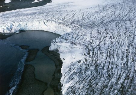
In total the ice sheets are losing around 500 cubic kilometres of ice per year. This ice mass corresponds to a layer that is about 600 metres thick and would stretch out over the entire metropolitan area of Hamburg, Germany’s second largest city.
“The new elevation maps are snapshots of the current state of the ice sheets. The elevations are very accurate, to just a few metres in height, and cover close to 16 million km2 of the area of the ice sheets. This is 500,000 square kilometres more than any previous elevation model from altimetry,” said lead-author Dr. Veit Helm, glaciologist at the Alfred Wegener Institute in Bremerhaven.
For the new digital maps, the AWI scientists had evaluated all data by the CryoSat-2 altimeter SIRAL. Satellite altimeter measure the height of an ice sheet by sending radar or laser pulses in the direction of the earth.
These signals are then reflected by the surface of the glaciers or the surrounding waters and are subsequently retrieved by the satellite. This way the scientists were able to precisely determine the elevation of single glaciers and to develop detailed maps.
On the basis of further CrysoSat-2 the scientists also documented how the elevation has changed over the 2011–2014 period. Ice sheets gain mass through snowfall and lose it due to melting and accelerating glaciers, which carry ice from the interior of the ice sheet to the ocean.
“We need to understand where and to which extent the ice thickness across the glaciers has changed. Only then can we can analyse the drivers of these changes and find out how much ice sheets contribute to global sea level rise,” said Veit Helm.
The team derived the elevation change maps using over 200 million SIRAL data points for Antarctica and around 14.3 million data points for Greenland. The results reveal that Greenland alone is reducing in volume by about 375 cubic kilometres per year.
“When we compare the current data with those from the ICESat satellite from the year 2009, the volume loss in Greenland has doubled since then. The loss of the West Antarctic Ice Sheet has in the same time span increased by a factor of 3. Combined the two ice sheets are thinning at a rate of 500 cubic kilometres per year. That is the highest speed observed since altimetry satellite records began about 20 years ago,” said AWI glaciologist Prof. Dr. Angelika Humbert, another of the study’s authors.
The areas where the researchers detected the largest elevation changes were Jakobshavn Isbrae (Jakobshavn Glacier) in West Greenland and Pine Island Glacier in West Antarctica.
Since February 2014 scientists know that the Jakobshavn Isbrae is moving ice into the ocean at a record rate of up to 46 meters a day. The Pine Island Glacier hit the headlines in July 2013. Back then AWI scientists reported that a table iceberg as large as the area of Hamburg had broken off the tip of its ice shelf.
But whereas both the West Antarctic Ice Sheet and the Antarctic Peninsula, on the far west of the continent, are rapidly losing volume, East Antarctica is gaining volume – though at a moderate rate that doesn’t compensate the losses on the other side of the continent.
We use cookies to improve your experience. By continuing to use our site, you accept our Cookies, Privacy Policy,Terms and Conditions. Close X