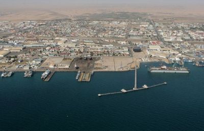
Plans are underway to expand the port limits of Walvis Bay in the few weeks to come, once the new boundary is published in the Official Gazette. Port Captain of Walvis Bay, Mussa Mandia, confirmed the expansion, amid reported complaints from officials in the shipping industry. Recent Media reports quoted two members of the shipping industry complaining that the fairway-buoy was relocated without the industry being notified in view of the confirmation of the expansion plans of the port. The duo who prefer to remain anonymous, are stakeholders in the shipping industry.
They are concerned about Namport relocating the fairway buoy one nautical mile northwards. The relocation has reportedly in some operational miscalculations. “The vehicle carrier Nordic Spirit, for instance, arrived at the new position of the fairway buoy last Friday, but the agent thought it was still anchored at the same location. It resulted in a subsequent delay to discharge vehicles”.
Mandi told Informanté on Monday, “we relocated the fairway buoy on 17 June this year because the main channel providing access for ships into port had been extended by one nautical mile during the last dredging operations”. According to him, the fairway buoy indicates the entrance of the channel; hence, it had to be relocated because the channel’s entrance moved one nautical mile northward.
He explained that the vehicle carrier in particular was advised by port control of the new location of the fairway buoy and the vessel arrived at the correct point. The fact that the industry did not know about the relocation was due to the fact that Namport was still in the process of relocating the fairway buoy and had little time left to notify all stakeholders in the shipping industry. Namport say it had informed the shipping industry after completing the said relocation.
“Walvis Bay Radio and the Marine Rescue Coordination Centre (MRCC) in Cape Town were notified in advance in the interest of safety”, said Mandia.
The Captain said changes to the channel’s length and location of the fairway buoy will be charted on all future maritime maps, to be done either by the hydrographer of the South African Navy or the hydrographer of the British Admiralty Authority.
An extensive dredging operation took place at the end of last year, which saw the deepening of the main channel and the turning basin of the port between berths one and three to 14 meters chart datum, to enable the accommodation of larger vessels.
As a result of the new depth, the port of Walvis Bay was able to accommodate the biggest container vessel ever to date to dock on Africa’s’ west coast, the WAFMAX Maersk “Conakry”. Walvis Bay is now a regular port of call for “Conakry” and her sister vessel WAFMAX, servicing the trade route between the Far East and West Africa.
The expansion of the port limits, the new northern boundary will be an imaginary line between Long Beach and Pelican Point. The extended main channel will remain within the new port limits.
The main channel is the only route for large ships (deep draft vessels) to sail in and out of the port of Walvis Bay, but will excludes fishing vessels operating from Walvis Bay’s fishing harbor, which uses the fishing harbour’s own channel.
In normal situations, tug-boats assist to steer vessel through the main channel to their respective berths in port, or when the vessels depart port. Namport also employs marine pilots who must board all vessels at the entrance of the channel, with the purpose of steering the vessel safely through the channel into port and out.
By Floris Steenkamp (Informante)
We use cookies to improve your experience. By continuing to use our site, you accept our Cookies, Privacy Policy,Terms and Conditions. Close X